Geography of Bosnia & Herzegovina
Bosnia and Herzegovina is located in Southeastern Europe, in the western Balkans. It has a 932 km border with Croatia to the north and southwest, a 357 km border with Serbia to the east, and a 249 km border with Montenegro to the southeast. It borders the Adriatic Sea along its 20 km (12.42 mi) coastline.
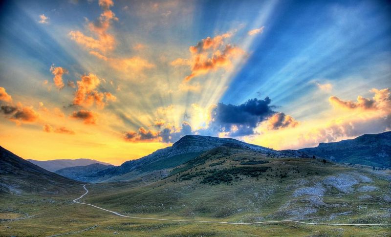
The most striking features of the local terrain are valleys and mountains which measure up to 2386 m in height. The country is mostly mountainous, encompassing the central Dinaric Alps. The northeastern parts reach into the Pannonian basin, while in the south it borders the Adriatic sea.
The country’s name comes from the two regions Bosnia and Herzegovina, which have a very vaguely defined border between them. Bosnia occupies the northern areas which are roughly four fifths of the entire country, while Herzegovina occupies the rest in the southern part of the country.
The major cities are the capital Sarajevo, Banja Luka in the northwest region known as Bosanska Krajina, Bijeljina and Tuzla in the northeast, Zenica and Doboj in the central part of Bosnia and Mostar, the capital of Herzegovina.
Central Bosnia is the most mountainous part of Bosnia featuring prominent mountains Vlašić, Čvrsnica, and Prenj. Eastern Bosnia also features mountains like Trebević, Jahorina, Igman, Bjelašnica and Treskavica. It was here that the 1984 Winter Olympics were held.
Eastern Bosnia is heavily forested along the river Drina, and overall close to 50% of Bosnia and Herzegovina is forested. Most forest areas are in Central, Eastern and Western parts of Bosnia. Northern Bosnia contains very fertile agricultural land along the river Sava and the corresponding area is heavily farmed. This farmland is a part of the Parapannonian Plain stretching into neighbouring Croatia and Serbia. The river Sava and corresponding Posavina river basin hold the cities of Brčko, Bosanski Šamac, Bosanski Brod and Bosanska Gradiška.
The northwest part of Bosnia is called Bosanska Krajina and holds the cities of Banja Luka, Prijedor, Sanski Most, Jajce, Cazin, Velika Kladuša and Bihać. Kozara National Park and Mrakovica World War II monument is located in this region.
The country has only 20 kilometres (12.4 mi) of coastline, around the town of Neum in the Herzegovina-Neretva Canton, and although surrounded by Croatian peninsulas, it is possible to get to the middle of the Adriatic from Neum. By United Nations law, Bosnia has a right of passage to the outer sea. Neum has many hotels and is an important tourism destination.

Climate of Bosnia & Herzegovina
Bosnia and Herzegovina has the temperate continental climate type, which is represented mostly in the northern and central parts of the country; the sub-mountainous and mountainous type (over 1000 m) and the Adriatic (Mediterranean) and modified Adriatic climate type, which is represented in coastal Adriatic area and the Herzegovinian lowlands.
The climate of Bosnia and Herzegovina therefore varies from a temperate continental climate in the northern Pannonia lowlands along the Sava River and in the foothill zone, to an alpine climate in the mountain regions, and a Mediterranean climate in the coastal and lowland areas of the Herzegovina region in the south and southeast.
In the northern part of the country, air temperature generally ranges between -1 and -2°C in January and between 18 and 20°C in July. In highlands with the altitude above 1000 m, the average temperature ranges from -4 to -7°C in January to 9 to 14°C in July. On the Adriatic coast and in the lowland regions of Herzegovina, air temperature ranges from 3 to 9°C in January to 22 to 25°C in July (for the period 1961-1990). Extremes of -41.8°C (low) and 42.2°C (high) have been recorded.
Annual precipitation amounts range from 800 mm in the north along the Sava River to 2000 mm in the central and southeastern mountainous regions of the country (period 1961-1990), with average annual precipitation in BH at about 1,250 mm.
The duration of sunshine decreases from the sea towards the mainland and at higher altitudes. Annual duration of sunshine in the central mountainous area is 1700-1900 hours, in southern regions, there are 1900-2300 hours of sunshine (Mostar = 2285 hours). In northern Bosnia and Herzegovina, there are 1800-2000 hours of sunshine, more in the eastern part than in the western part. Cloudiness declines from the west to the east.
More info about the climate of Bosnia & Herzegovina: http://www.unfccc.ba/klimatski_atlas/index.html.


Comments are closed.